
Development
Strengthening logistics functions is a major policy in the Nagoya Port Plan formulated by the port authority.
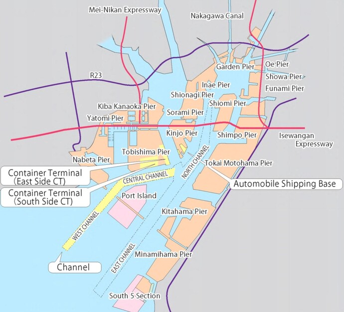
Below are the major port plans for the future at the Port of Nagoya.
(*Yellow areas in the map indicate planned construction sites listed below. Some of them are already
completed and in use)
Container Terminal
Tobishima Pier South Side Container Terminal
- Water depth
- -16.0m
- Berth length
- 1,200m (3 berths)
- Others
- Reinforced earthquake-resistant structure
(3 berths)
* Two berths are already in service.
Tobishima Pier East Side Container Terminal
- Water depth
- -15.0m
- Berth length
- 1,400m(4 berths)
- Others
- Reinforced earthquake-resistant structure
(2 berths)
* Two berths on NCB Container Terminal are being deepened to 15 m. When completed, 4 consecutive berths including 2 berths on adjacent Tobishima South Container Terminal will form a 1,400 m quay with a water depth of 15 m.
Kinjo Pier Automobile Handling Base
- Water depth
- -12.0m
- Berth length
- 520m(2 Berth), 260m(1 Berth)
- Land reclamation
- Approx. 19 ha
- Others
- Reinforced earthquake-resistant structure
(1 berth)
Channels
Expansion and further deepening
- West channel
- 14m deep, 400-540m wide
- Central channel
- 14-16m deep, 400m wide